511now / Answers / Wildfire smoke today
Wildfire smoke today
Updated August 19, 2026 · Pictures refresh every few minutes
For a number, check AirNow — the official EPA air quality map. For your own eyes, look at the cameras below: on a smoky day the ridgelines wash out gray.
We never invent an AQI, and we never say a smoke plume is or is not a fire. The number comes from AirNow; the pictures come from the agencies.
See the haze for yourself
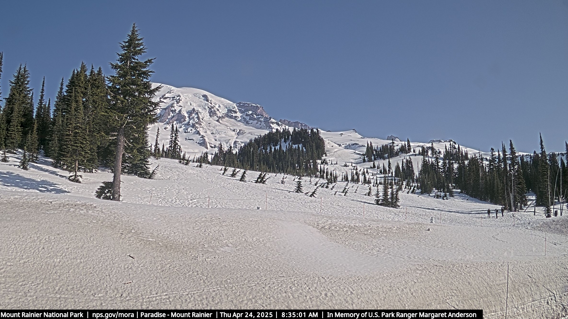 Rainier · ParadiseNPS
Tap a picture to open the gallery — every official smoke camera we track, with zoom. Dust, clouds, and steam can look like smoke — the picture shows haze, not a diagnosis.
Hiking today? Check the trailhead, not your city
Smoke pools in some valleys and skips others. Use AirNow for the area you are hiking, not where you slept. AirNow also publishes activity guidance for each air-quality level — that guidance is theirs to give, not ours.
The cameras answer a simpler question: is the view you are hiking to even visible today? Check Rainier, Crater Lake, or the Olympics before you drive two hours.
Driving through smoke
Smoke alone rarely closes a highway, but a fire near the road can. Check the official 511 page for your route — WSDOT, TripCheck, or Idaho 511 — then the fire map for named fires near it. If smoke drops visibility, slow down and use low beams, not high.
Does smoke mean a fire near me?
Not always. Smoke rides the wind for hundreds of miles — Seattle haze can come from fires in British Columbia or Eastern Oregon. The fire map shows official NIFC perimeters for named fires.
This site never issues evacuation orders. For evacuations, use your county alerts, Wireless Emergency Alerts (WEA), or Watch Duty. If you see new fire or smoke and believe no one has reported it, call 911. If you feel unsafe, leave early — you do not need an order.
Check by state
- Washington: smoke cameras · fire map
- Oregon: smoke cameras · fire map
- Idaho: smoke cameras · fire map
Sources
- AirNow — official EPA air quality, including the fire and smoke map.
- NIFC — official wildfire perimeters.
- Oregon Hazards Lab — the lookout cameras.